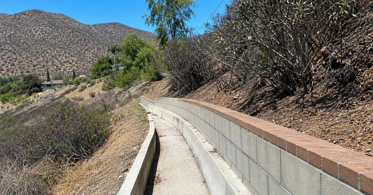
On a Paradise Canyon listing that sat pretty at the mouth of an arroyo, the house checked out fine. The lot was the question. Uphill sat burnable national forest, and the drainage that was supposed to move a storm around the home was a shallow, silted channel half-blocked with leaves and a landscape wall that pinched it tighter. In a dry year, none of that matters. In the first big rain after a fire on those slopes, it matters a great deal.
This is the part of a La Cañada Flintridge purchase that a standard walkthrough misses. The city sits against the front range of the San Gabriels, and its northern edge is wildland-urban interface. When those slopes burn, and they have, the ground loses the vegetation and soil structure that held it, and the next storms send mud, rock, and debris down the canyons. The 2009 Station Fire was followed in the winter of 2010 by debris flows that filled and overtopped basins above the city and turned streets into channels.
This guide is for the agent working the foothill neighborhoods. Here is what post-fire debris flow actually is, how a home is protected from it, and how to keep a deal moving when the lot carries that exposure.
Why this matters for the agent
Here is what is at stake. Debris flow is not a slow drainage nuisance. It is a fast-moving slurry of water, mud, boulders, and burned vegetation that can arrive with little warning and hit with enough force to damage or destroy a structure in its path. The homes most exposed are the ones near canyon mouths, arroyos, and the outlets of the debris basins that the county built to catch this material.
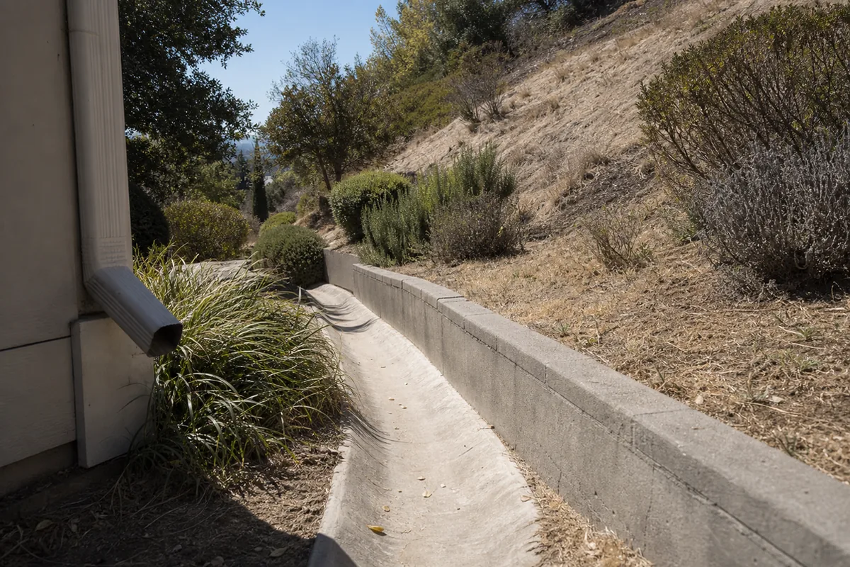
For your buyer, this is a lot-level risk that sits on top of the house itself. It touches insurance, it touches natural hazard disclosure, and it can touch financing when a property is mapped in a hazard area. An agent who understands the exposure can talk about it accurately, point the buyer to the right evaluations, and set expectations before the offer. The agent who treats a canyon-mouth lot like any other flat lot is setting the buyer up for a surprise that a rainy season will eventually deliver. We have inspected homes where the drainage was the most important thing on the property, and nobody was looking at it.
What post-fire debris flow actually is
A debris flow starts on a burned slope. Fire strips the vegetation and can bake the soil into a water-repellent layer, so when rain falls, instead of soaking in it runs off fast, picking up ash, soil, rock, and anything loose on the way down. That mixture moves through the canyons and arroyos with far more force and volume than clear water, and it does not need a record storm to start. Federal hazard assessments after a fire routinely find that even a modest, short, intense burst of rain can trigger damaging flows in the first year or two after a burn.
La Cañada Flintridge lives with this directly. The debris basins above the city, run by the county, exist to catch this material before it reaches homes, and in the 2010 season after the Station Fire, some of those basins filled and overtopped, sending mud and rock into the streets and yards below. The risk fades as the slopes revegetate over several years, then resets with the next fire. So the exposure on a given lot depends on where it sits relative to the canyons and basins, and on how well the site’s own drainage is set up to handle water and debris moving downhill. The foothill towns nearby carry related exposures, from Sierra Madre’s fire-hardening challenge on historic homes to the defensible-space rules that decide insurability.
What agents should tell every buyer
When a buyer is considering a foothill home in La Cañada Flintridge, give them these points before they write.
- On a foothill lot, the drainage and the site are part of the purchase, not just the house. Ask where the water goes in a storm and what is uphill of the property.
- Post-fire debris flow is a real, mapped hazard here. Encourage the buyer to review the natural hazard disclosure and any geologic or flood mapping for the specific parcel.
- Proximity to a canyon mouth, an arroyo, or a debris-basin outlet raises the exposure. A geotechnical or civil engineer can assess a specific lot.
- Insurance matters. Flood and debris-flow related coverage is a separate conversation from a standard homeowner policy, so the buyer should talk to their insurer early.
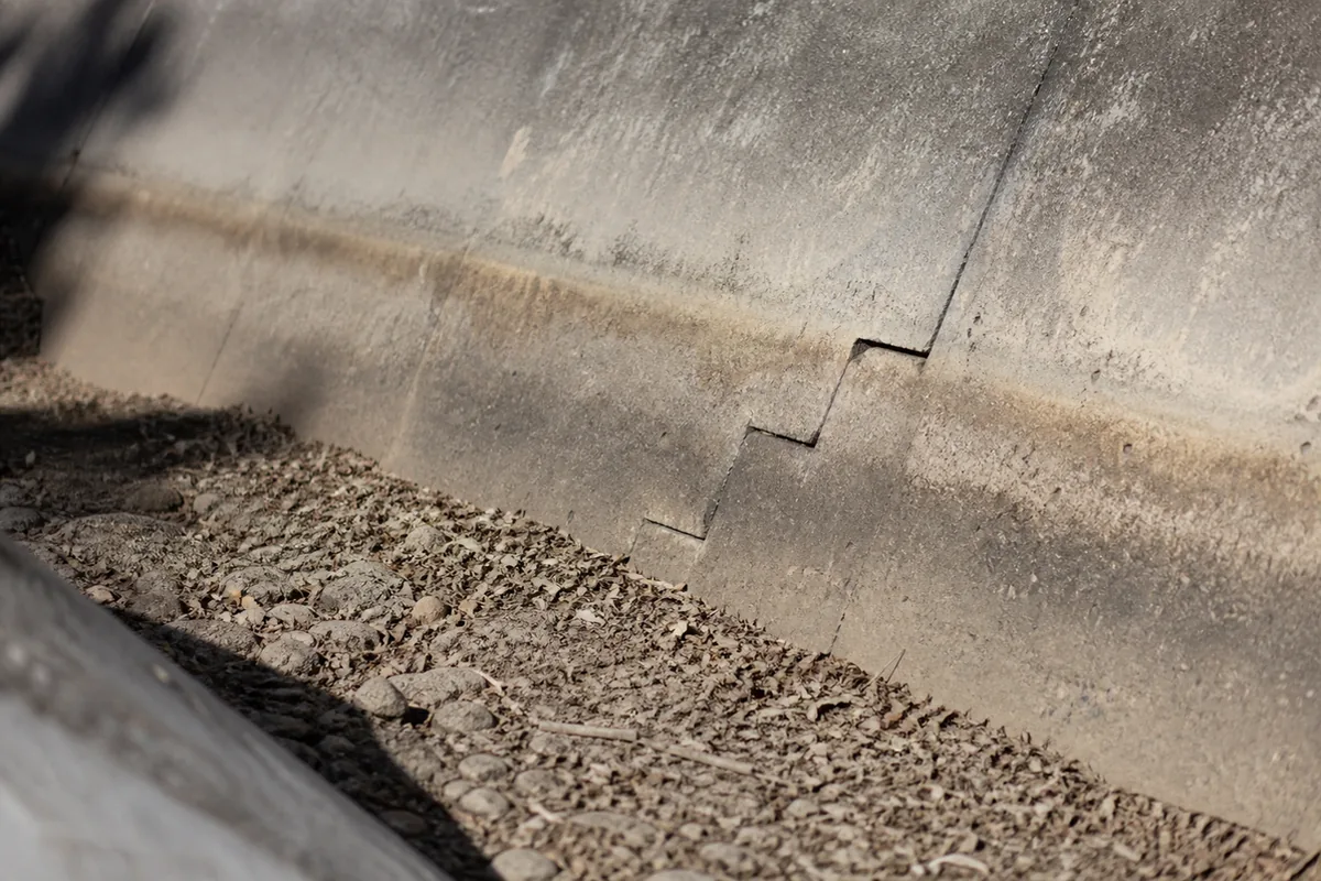
- Site drainage features, channels, deflection walls, and retaining, only work if they are maintained. Silted, blocked, or undersized drainage is a real finding. The same lesson applies to hillside retaining walls and slope drainage anywhere on graded ground.
- The home inspection documents the visible drainage, slope, and retaining condition. A geotechnical engineer evaluates the hazard. Our what every inspection includes page shows how far we go on the site.
A buyer who hears this from you understands they are buying a lot and a setting, not just a house, and they respect you for saying so.
Red flags during showings
You can spot a lot of this from the driveway and the yard. Watch for these.
- A home sitting at or near the mouth of a canyon or arroyo, or just below a debris-basin outlet.
- Drainage channels, swales, or brow ditches that are silted, cracked, blocked with debris, or clearly undersized.
- Landscape walls or additions that pinch or redirect a natural drainage path.
- Fresh sediment, rock, or mud staining in the yard, on the driveway, or against the uphill wall of the house.
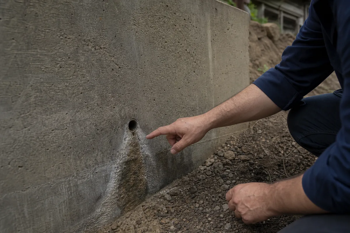
- Retaining walls that are cracked, leaning, bulging, or weeping, especially on the uphill side. When cracks keep coming back, it can signal active earth movement rather than simple settling.
- Downspouts and area drains that discharge against the foundation instead of away from it.
If we see these, we document them and recommend the buyer bring in a geotechnical or civil engineer before the contingency clears.
The negotiation playbook
When drainage or debris-flow exposure surfaces, the deal usually moves one of a few ways.
The first path is seller-corrects the site. The seller clears and repairs the drainage, fixes or replaces a failing retaining wall, and restores the deflection features, with engineering where required, before closing. This is cleanest when the issue is maintenance or a defined repair. Push for it when the fix is bounded.
The second path is a credit with an engineer’s scope. The buyer takes a closing credit sized to a civil or geotechnical engineer’s written recommendation and does the work after closing. This works when the buyer is comfortable managing it. Size the credit to the engineer’s number, because drainage and retaining work can grow once the ground is opened.
The third path is the disclosure-and-insurance route. Sometimes the site is sound but the parcel carries mapped hazard exposure that the buyer simply needs to understand and insure for. Here the work is information: the natural hazard disclosure, the engineer’s read, and the insurer’s terms. The buyer proceeds with eyes open, or adjusts the offer for the risk.
The fourth path is walk-away. On occasion a lot sits squarely in a high-exposure position with a marginal drainage setup, and the buyer decides the setting is more risk than they want. That is a legitimate call. We document what we found and when, and the decision belongs to the buyer and their engineer.
How the inspection actually catches it
A home inspection is not a geotechnical study, and we say so clearly. What we do on a foothill La Cañada Flintridge lot is document the visible site conditions that a buyer needs to weigh: where the property sits relative to slopes and canyons, the condition of the drainage channels and area drains, the retaining walls and any signs of movement, and how the downspouts and grading move water around or toward the house. We look for sediment and debris staining that tells us water has come through before, and we note anything that pinches or blocks a drainage path.
We use drone imagery to read the uphill context and the roof, and thermal imaging inside to catch moisture from past water intrusion, a technique our guide on why infrared scanning matters in California homes explains. What we do not do is model the debris-flow hazard or certify a slope. That is the geotechnical or civil engineer’s job, and for anything structural in the retaining or foundation we point to a structural engineer. If we see something worth flagging, it goes in the report, and our how to read a home inspection report guide helps the buyer weigh it. For the related structural side of foothill homes, our Glendale masonry chimney and earthquake guide covers another item common in this area.
Schedule a La Cañada Flintridge inspection →
Quick FAQ
Is debris flow the same as a flood? Not exactly. A flood is mostly water. A debris flow is a fast, dense slurry of water, mud, rock, and burned vegetation off a fire-scarred slope, and it carries far more destructive force. It can also be covered differently by insurance, which is why a buyer should ask their insurer specifically about it.
How do I know if a specific home is exposed? Position relative to canyons, arroyos, and debris-basin outlets is the biggest factor. The natural hazard disclosure and county and federal hazard mapping are the starting point, and a geotechnical or civil engineer can assess the individual parcel. We flag the visible site clues that say a closer look is warranted, and our inspection FAQ explains how those findings appear in the report.
Do the debris basins make it safe? The county debris basins are a major protection and they catch enormous volumes of material. They are not a guarantee. In the 2010 season after the Station Fire, some basins filled and overtopped. Proximity and site drainage still matter, and maintenance of both the public and the private drainage is part of the picture.
Is this only a risk right after a fire? The highest risk is in the first year or two after a burn on the slopes above, before vegetation returns. It fades as the hillsides recover and resets with the next fire. Because these foothills burn periodically, the exposure is a long-term feature of the setting, not a one-time event.
Does the home inspection cover debris-flow risk? The inspection documents the visible site drainage, slope, and retaining condition and flags concerns, all captured in the inspection report with photos. It does not model the hazard or certify the slope. For that, we point the buyer to a geotechnical or civil engineer, and to the natural hazard disclosure.
The honest summary
La Cañada Flintridge is a beautiful foothill city, and the same slopes that give it its setting are the ones that burn and then shed debris in the rains that follow. On the canyon-mouth and arroyo-adjacent lots, the drainage and the site are as important as anything inside the house. None of that is a reason to steer a buyer away from the foothills. It is a reason to look uphill, read the disclosure, get an engineer on the questionable lots, and make sure the private drainage is actually doing its job.
We will document the site and the drainage honestly, tell your buyer what the lot is dealing with, and point them to the right engineer. That is the job. We also inspect the neighboring foothill communities, including Sierra Madre, Pasadena, and Glendale. For a coastal slope with its own documented movement history, see our La Jolla Mount Soledad landslide guide, and for a terraced decomposed-granite hillside further south, see our San Marcos retaining wall guide.
See what every inspection includes → · Explore La Cañada Flintridge home inspections →